


GERMANY FROM ABOVE
1st Season
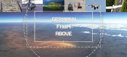
Episode 2: Country
Since the fall of the Iron Curtain — which divided Western from Eastern Europe straight through Germany — Germany has become the biggest transit country in Europe. The Autobahnen are the most heavily trafficked roads and special aircraft monitor the organised chaos when the holiday season begins, or accidents bring the apparently endless flow of traffic to a standstill.
But no matter how many Autobahns dissect the country, the skies offer many more transit routes. Millions of migratory birds — from reed warblers to wild geese, from storks to cranes — follow their ancient pathways over German skies each spring and autumn. Some spend their summer here and raise a family; others are merely passing through, travelling from Central Africa to Scandinavia or back again.
“Germany From Above“ flies with cranes along part of their migrating route to the South, looks into the nest of storks in the north German village of Bergenhusen and follows them in their summer thermic trips in the Elbe Valley. Elaborate animations based on real GPS data show in satellite pictures the routes followed by migrating birds.
Germany From Above flies with cranes along part of their migration route south, peers into the nests of storks in the north German village of Bergenhusen, and follows them on their summer thermal flights through the Elbe Valley. Elaborate animations based on real GPS data trace the routes of migratory birds across satellite images.
Yet birds must share the airspace with air traffic. No other European airspace is as filled with invisible routes and corridors as the German skies. Animations based on real GPS data capture the relentless traffic of Europe’s biggest air route network and the frenetic bustle of taking off and landing at Germany’s two biggest airports: Frankfurt and Munich.
Even flights from Vladivostok to London pass over Germany. How does the air traffic control centre in Frankfurt monitor the relentless flow of traffic in the skies above us? And what does Germany look like from the cramped cockpit of Lieutenant Colonel Jochen Ruff-Stahl’s Phantom jet, when he takes off from the air force base at Wittmund in East Friesland to train at supersonic speed?
Other unlikely people also make use of the bird’s-eye view. Farmer Clement Sjöberg in Schleswig-Holstein uses satellite signals to guide his combine harvester and tractors, allowing the machines to work the fields with absolute precision. The Elbe Sandstone Mountains are being surveyed with modern laser technology from an aircraft to produce 3D models of what may be the most extraordinary landscape in Europe. Archaeologist Martin Schaich also uses high-tech lasers to measure the Limes — the longest earthwork monument in Europe — flying over it in an ultralight aircraft.
But alongside all the traffic routes across and above Germany, flying over the country also brings unexpected surprises: the almost uninhabited landscapes that defy access. In the Alps around Berchtesgaden, some remote lodges can only be supplied by helicopter — from a can of beer to a roof gutter, everything must be transported by air. In some remote areas of the Central German Uplands, the Elbe Valley or the Alps, Germany almost looks like Canada, New Zealand or Scandinavia. Golden eagles find shelter here. Sky is one of them. Fly with him and see his country from a perspective that makes it appear mysterious and utterly foreign.
But no matter how many Autobahns dissect the country, the skies offer many more transit routes. Millions of migratory birds — from reed warblers to wild geese, from storks to cranes — follow their ancient pathways over German skies each spring and autumn. Some spend their summer here and raise a family; others are merely passing through, travelling from Central Africa to Scandinavia or back again.
“Germany From Above“ flies with cranes along part of their migrating route to the South, looks into the nest of storks in the north German village of Bergenhusen and follows them in their summer thermic trips in the Elbe Valley. Elaborate animations based on real GPS data show in satellite pictures the routes followed by migrating birds.
Germany From Above flies with cranes along part of their migration route south, peers into the nests of storks in the north German village of Bergenhusen, and follows them on their summer thermal flights through the Elbe Valley. Elaborate animations based on real GPS data trace the routes of migratory birds across satellite images.
Yet birds must share the airspace with air traffic. No other European airspace is as filled with invisible routes and corridors as the German skies. Animations based on real GPS data capture the relentless traffic of Europe’s biggest air route network and the frenetic bustle of taking off and landing at Germany’s two biggest airports: Frankfurt and Munich.
Even flights from Vladivostok to London pass over Germany. How does the air traffic control centre in Frankfurt monitor the relentless flow of traffic in the skies above us? And what does Germany look like from the cramped cockpit of Lieutenant Colonel Jochen Ruff-Stahl’s Phantom jet, when he takes off from the air force base at Wittmund in East Friesland to train at supersonic speed?
Other unlikely people also make use of the bird’s-eye view. Farmer Clement Sjöberg in Schleswig-Holstein uses satellite signals to guide his combine harvester and tractors, allowing the machines to work the fields with absolute precision. The Elbe Sandstone Mountains are being surveyed with modern laser technology from an aircraft to produce 3D models of what may be the most extraordinary landscape in Europe. Archaeologist Martin Schaich also uses high-tech lasers to measure the Limes — the longest earthwork monument in Europe — flying over it in an ultralight aircraft.
But alongside all the traffic routes across and above Germany, flying over the country also brings unexpected surprises: the almost uninhabited landscapes that defy access. In the Alps around Berchtesgaden, some remote lodges can only be supplied by helicopter — from a can of beer to a roof gutter, everything must be transported by air. In some remote areas of the Central German Uplands, the Elbe Valley or the Alps, Germany almost looks like Canada, New Zealand or Scandinavia. Golden eagles find shelter here. Sky is one of them. Fly with him and see his country from a perspective that makes it appear mysterious and utterly foreign.
Facts
Nominated for the German TV Prize (Deutscher Fernsehpreis) and for Adolf-Grimme-Prize
First aired 30th May 2010 at 7.30pm on ZDF
Credits
Written, directed and produced by: Petra Höfer and Freddie Röckenhaus
Aerial Photography: Peter Thompson
Director of Photography: Marcus von Kleist, Johannes Imdahl, Thomas Schäfer, Torbrjörn Karvang, Thomas von Kreisler, Hanno Hart u.a.
Video Editor: Jörg Wegner, Maren Grossmann
Producer: Friederike Schmidt-Vogt, Susanne Rostosky, Francesca D`Amicis, Kay Schlasse, Sandra Schmidt
Line Producer: Svenja Mandel
Narration: Leon Boden
Commissioning Editors: Friederike Haedecke (ZDF), Alexander Hesse (ZDF)
A colourFIELD production commissioned by ZDF


